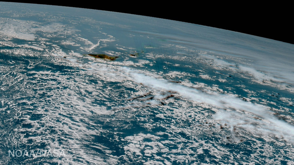
30 Jan Hawaii as seen from GOES-16
The Hawaii island chain is seen at the western extent of GOES-16, NOAA’s next-generation geostationary satellite! Captured at 1:07pm EST on January 15, 2017 and created using several of the 16 spectral channels available on GOES-16’s sophisticated Advanced Baseline Imager, this image is among a handful...