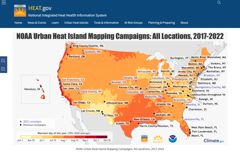
03 Mar NOAA Brings Heat Island Data to Life With Maps, VR
The National Oceanic and Atmospheric Administration is working with cities to use visualizations to make urban heat island data more accessible. For Washington, D.C., this work led to a virtual reality experience. The National Oceanic and Atmospheric Administration (NOAA) is offering a new perspective on urban...