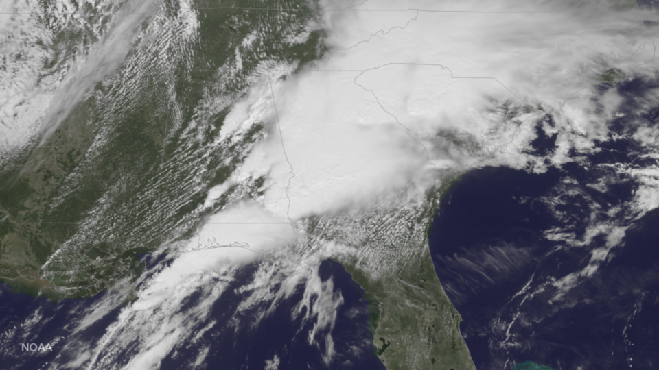
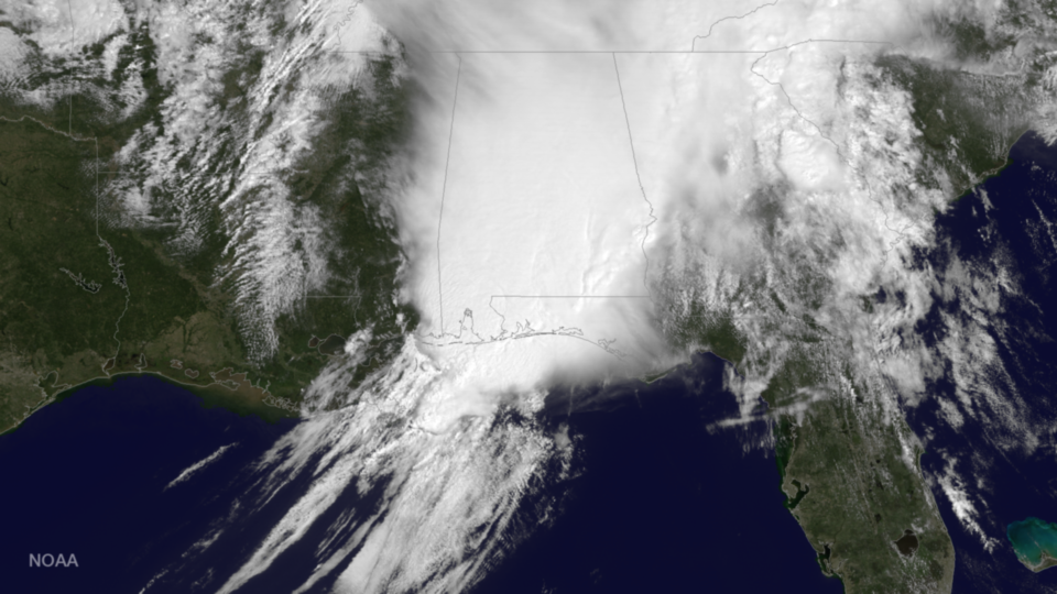
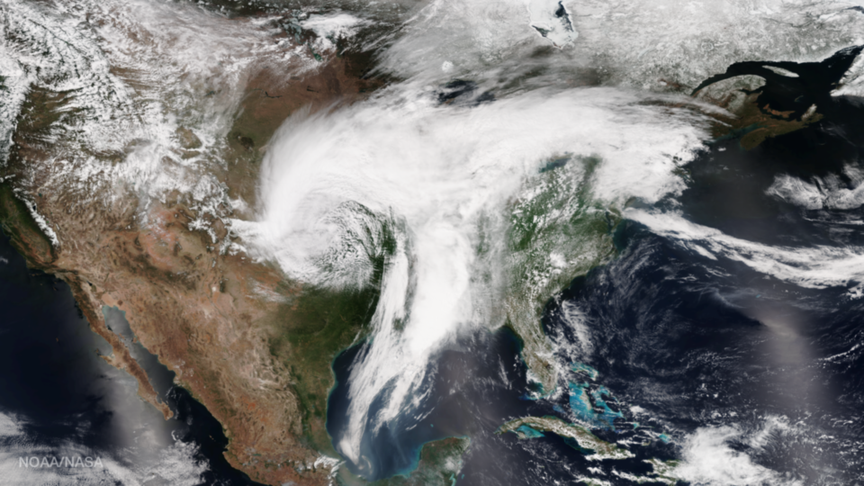
news Tag

NOAA’s GOES East satellite produced this visible image of the large and powerful weather system over the southeast at 1515 UTC today, April 5, 2017. According to the National Weather Service, intense supercell thunderstorms are expected to develop over parts of the region this afternoon. These...

GOES East captured this visible image of a large storm system over Alabama, Georgia and western Florida yesterday, April 3, 2017, at 1545 UTC. The threat for severe weather will continue through midweek in this area, and then the threat will shift into the Mid-Atlantic on...

A large plume of dust from the Sahara drifts off the African coast and out into the Atlantic in this true-color image captured by the Visible Infrared Imaging Radiometer Suite (VIIRS) instrument aboard the NOAA/NASA Suomi NPP satellite on April 2, 2017. Although we can see...

According to the latest information from the Joint Typhoon Warning Center (JWTC), Debbie is located approximately 108 nautical miles southeast of Townsville, Australia, and has tracked southwestward at just over 5 miles per hour over the past 6 hours. The storm has maximum sustained winds...

The Japan Meteorological Agency’s Himawari-8 satellite captured this true-color image of Tropical Cyclone Debbie closing in on the northeastern coast of Australia at 0510 UTC, March 27, 2017. According to the Joint Typhoon Warning Center (JWTC), Debbie is located approximately 295 nautical miles east-southeast of Cairns,...

Snow blankets northeastern New York State and most of New England in this true-color image captured by the Visible Infrared Imager Radiometer Suite (VIIRS) instrument aboard NOAA/NASA Suomi NPP on March 22, 2017. To create true-color images like this one, scientists combine data from three of...

There are only two times of the year when the Earth’s axis is tilted neither toward nor away from the sun, resulting in a “nearly” equal amount of daylight and darkness at all latitudes. These events are referred to as Equinoxes and occurred today, March...

The Visible Infrared Imaging Radiometer Suite (VIIRS) aboard the NOAA/NASA Suomi NPP satellite captured this true-color image of Tropical Cyclone Enawo in the Indian Ocean on March 5, 2017. Forecasters with the Joint Typhoon Warning Center (JWTC) report that Enawo is located approximately 399 nautical miles...