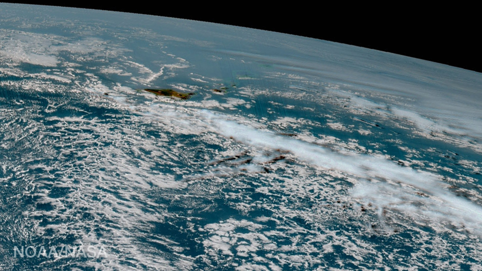
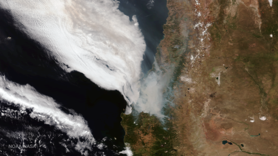
Author: admin

The Visible Infrared Imaging Radiometer Suite (VIIRS) instrument aboard the NOAA/NASA Suomi NPP satellite captured this true-color image of a huge plume of smoke rising into the atmosphere off the coast of central Chile on January 27, 2017. According to National Geographic, strong winds and minimal...

The Hawaii island chain is seen at the western extent of GOES-16, NOAA’s next-generation geostationary satellite! Captured at 1:07pm EST on January 15, 2017 and created using several of the 16 spectral channels available on GOES-16’s sophisticated Advanced Baseline Imager, this image is among a handful...

This true-color image from the Visible Infrared Imaging Radiometer Suite (VIIRS) instrument aboard the NOAA/NASA Suomi NPP satellite shows the amount of snow cover in the Sierra Nevada mountains on January 29, 2017. The series of storms that hit the area over the past several weeks...

IMSG scientist Jing Cheng presenting her poster “The Development of Data Assimilation System for the Regional Rapid-Refresh Model within the Enterprise Integrated Aviation Weather System (eIAWS ™)” at the 2017 American Meteorological Society Annual Meeting.   D ...

This true-color image captured by the NOAA/NASA Suomi NPP satellite’s Visible Infrared Imaging Radiometer Suite (VIIRS) instrument on January 10, 2017, shows the extent of the storm system that dropped several inches of snow over portions of Oregon and Washington and resulted in school closures,...

In this image from the Himawari-8 satellite captured on January 9, 2017, two large low-pressure systems spin in the northern and western regions of the Pacific Ocean. Himawari-8, the first unit of the Japan Meteorological Agency’s (JMA) third-generation of geostationary satellites, acquires visible, near-infrared and infrared...

Bands of lake effect snow drift eastward from the western Great Lakes in this true-color image captured by the NOAA/NASA Suomi NPP satellite’s Visible Infrared Imaging Radiometer Suite (VIIRS) instrument on January 5, 2017. National Weather Service forecasters expect light to moderate lake effect snow...

Created with data from the Global Forecast System model, this data visualization shows atmospheric moisture over the central Pacific Ocean on January 3. Satellites can detect this moisture and the data can then be used to calculate what’s known as the “total precipitable water” content...