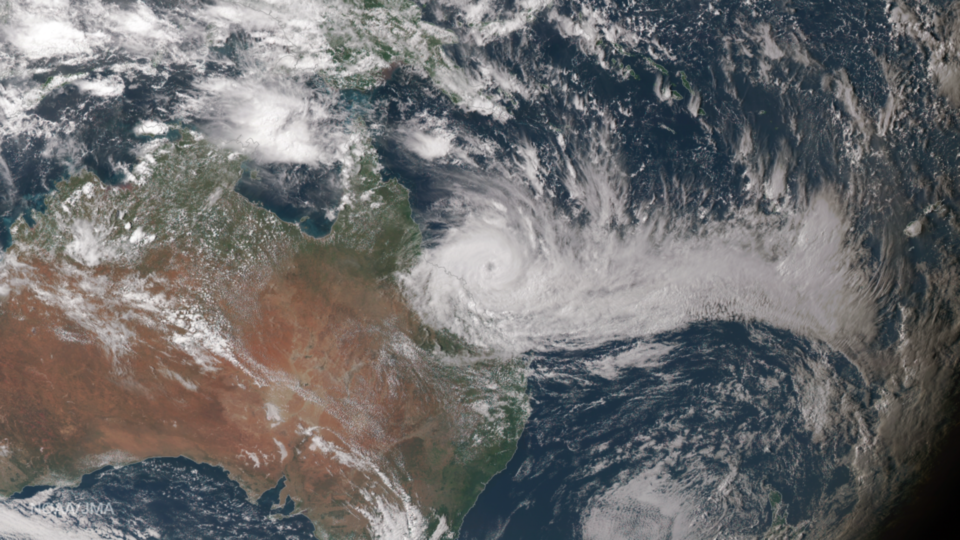
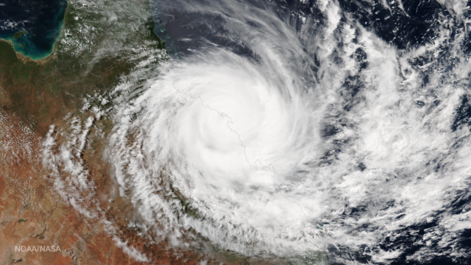
Author: admin

Snow blankets northeastern New York State and most of New England in this true-color image captured by the Visible Infrared Imager Radiometer Suite (VIIRS) instrument aboard NOAA/NASA Suomi NPP on March 22, 2017. To create true-color images like this one, scientists combine data from three of...

There are only two times of the year when the Earth’s axis is tilted neither toward nor away from the sun, resulting in a “nearly” equal amount of daylight and darkness at all latitudes. These events are referred to as Equinoxes and occurred today, March...

The Visible Infrared Imaging Radiometer Suite (VIIRS) aboard the NOAA/NASA Suomi NPP satellite captured this true-color image of Tropical Cyclone Enawo in the Indian Ocean on March 5, 2017. Forecasters with the Joint Typhoon Warning Center (JWTC) report that Enawo is located approximately 399 nautical miles...

Smoke plumes from a smattering of fires burning in the southeastern states of Louisiana and Mississippi bend toward the East in this image captured by the NOAA/NASA Suomi NPP satellite’s Visible Infrared Imaging Radiometer Suite (VIIRS) instrument on January 31, 2017. According to information from atmospheric...

The Visible Infrared Imaging Radiometer Suite (VIIRS) instrument aboard the NOAA/NASA Suomi NPP satellite captured this true-color image of a huge plume of smoke rising into the atmosphere off the coast of central Chile on January 27, 2017. According to National Geographic, strong winds and minimal...

The Hawaii island chain is seen at the western extent of GOES-16, NOAA’s next-generation geostationary satellite! Captured at 1:07pm EST on January 15, 2017 and created using several of the 16 spectral channels available on GOES-16’s sophisticated Advanced Baseline Imager, this image is among a handful...